"Paras out for a jolly"
One day I'm presenting on camera at work from home and out of the corner of my eye, I see a plane coming in fast and low, very low. Like, is this going to crash into the Bay low? I must of stopped or paused speaking, because people asked if my video froze or my connection dropped. I was watching a military plane loop Alcatraz Island so low I thought the wing was going to dip into the Bay.
I thought to myself, "do I grab my camera?"
Instead, in disbelief, I watched the plane rise up from between Angel and Alcatraz Island, bank around with the wings nearly vertical, and loop Alcatraz again.
"Holy shit", is what I said aloud.
"what's happening?", asked the people in the meeting.
"this plane, just looped Alcatraz in a very tight turn...", I slowly responded.
"Did you get a picture?", asked someone on the video call.
"Nope. Not sure the camera would start up and focus fast enough to get the picture anyway. That, was amazing.", I quipped.
It was a sight to see. The benefits of working mostly from home due to the endless pandemic.
Someone else must have seen it and taken a picture. Somewhere. I went hunting for someone else who took a picture on some social media site and found nothing.
Seriously!? This giant plane loops Alcatraz at super low altitude and no one else got a picture? video snippet? not even a mention?
I went on to ADSBExchange to find it in history, hoping the pilots turned on the transponder for their flight. It turns out, they had.
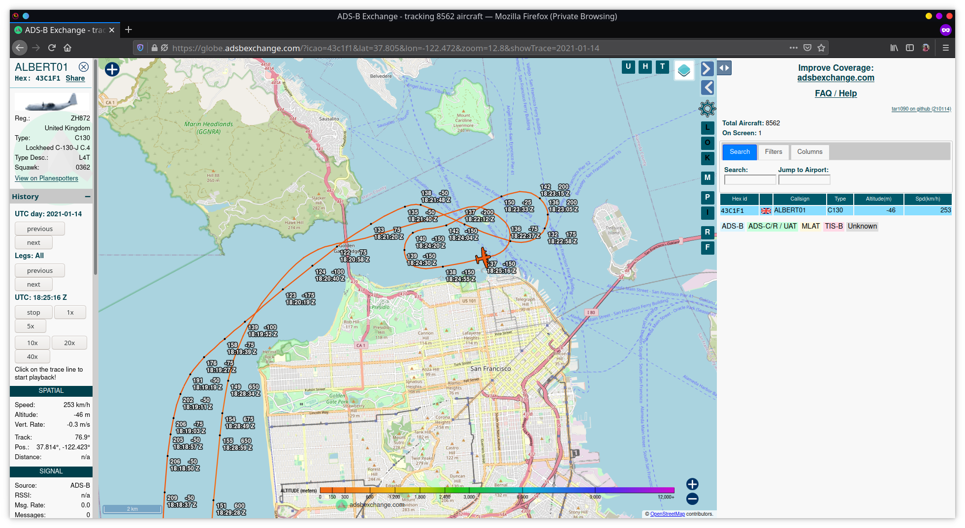
This is the recorded flight path through the Bay. Let me explain what you're seeing.
On the far top, left starting with ALBERT01 is the reported info via ADS-B transponder. ALBERT01 is what the pilot enters for the flight or plane name. Usually, this field represents the airline and flight number (like UAL237 for United Airlines flight 237, for example).
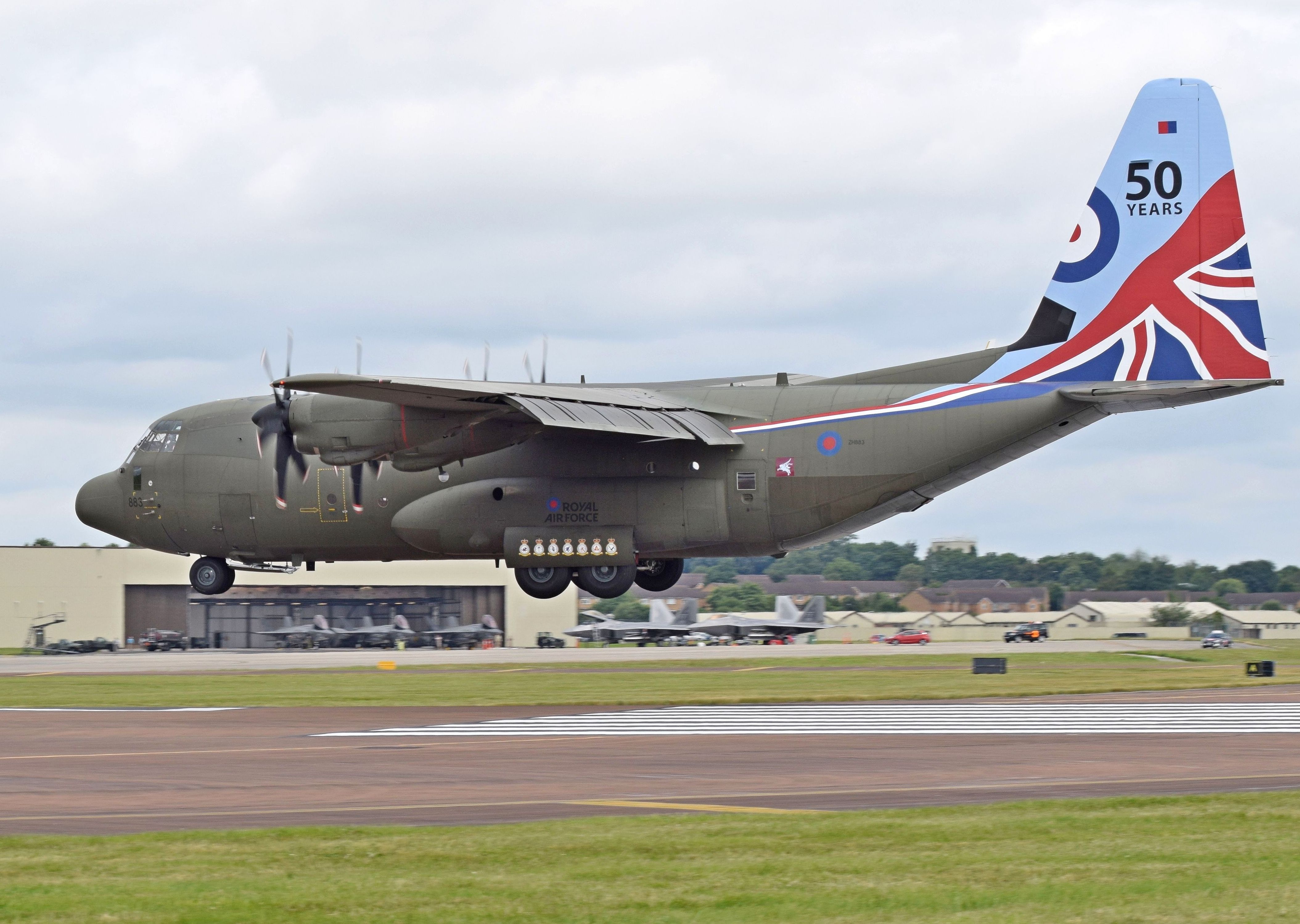
Next field down is the Hex code of the aircraft. Below that is the picture of the plane. Below the picture is the registration number. In this case it's ZH872. Here is a nice photo of the plane based on the registration number.

Back to the screen shot above the pretty plane. It's a United Kingdom Royal Air Force C130J-30 plane. Generally used for cargo or troop transport. Or paratroopers jumping out of the back.
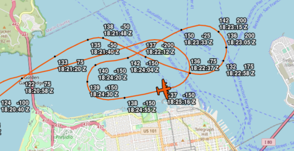
Above is a close-up of the loops around Alcatraz Island. Each black dot in the orange line is a recorded point. In reality, my raspberry pi is recording the radio transmissions from the transponder in near real-time, but showing thousands of points isn't easy to read by humans.
Let's break down the numbers at each point. The top left is air speed in kph. The top right is altitude in meters. The bottom is the timestamp in UTC (aka Zulu) time.
Starting from the left of the image, we seen the plane just before the Golden Gate Bridge at 18:20:58Z. It's speed is 122 kph and altitude is 75 meters.
The clearance height of the GGB is 67.1 m at high tide (source: Wikipedia). At 75 m, it likely means the plane buzzed the bridge, or flew under the bridge. The next point is just to the right of the bridge at time 18:21:20 Zulu. The plane reports 133 kph and 75 m altitude.
Around 18:21:40Z is when I saw the plane in the corner of my eye while presenting.
The plane passes between Alcatraz and San Francisco from 18:22:12Z to 18:22:37Z, does a tight loop around the Bay, swings behind Alcatraz, another tight loop to buzz the shoreline, and then back around Alcatraz. It then flies off past the GGB again, likely buzzing it or going under it.
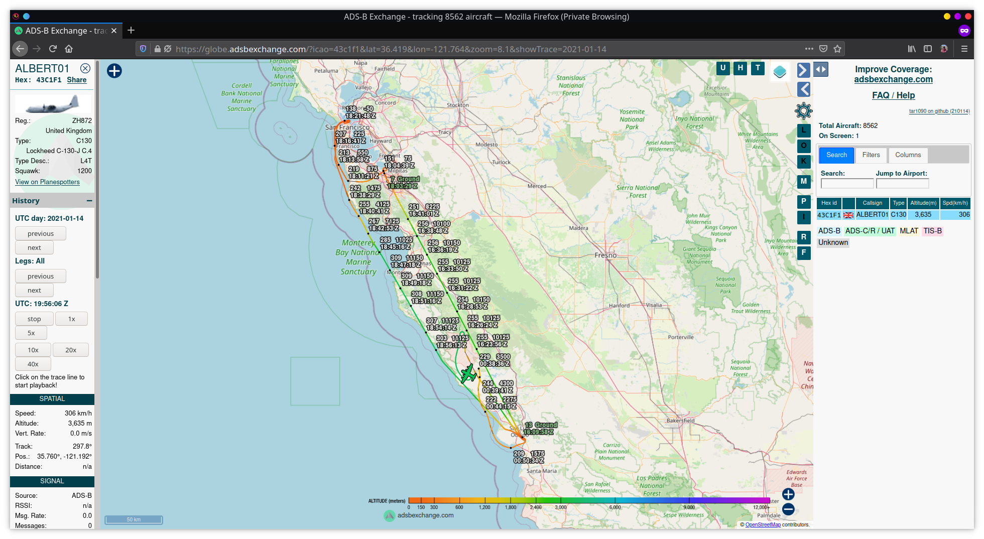
Here's the whole flight path as seen by ADSBExchange:
I posted this loop in the ADSBExchange chat room and a Brit responds, "paras out for a jolly, lol"
Or, the day the RAF buzzed The Bay. Amazing.
Extra
An astute person will notice the altitude readings go negative at points around Alcatraz. It's either a reporting error or the plane dipped below the flight horizon so the system picks it up as a negative altitude. The plane was not, in fact, in the water at any point in time. But it did get really, really close. -200m puts it pretty much at water level. It was pretty damned close to that for the first loop.
What's this raspberry pi you mentioned? For cheap money, you can either build your own, or buy a kit and plug it in. Of all the flight tracking services, I prefer ADSBExchange because they don't filter any traffic. Many other services filter out filghts, planes, and/or all military air traffic. Trust me, if the military planes don't want to be seen, they don't turn on their transponders. In fact, they are seen visually and heard. But electronically, they don't exist.
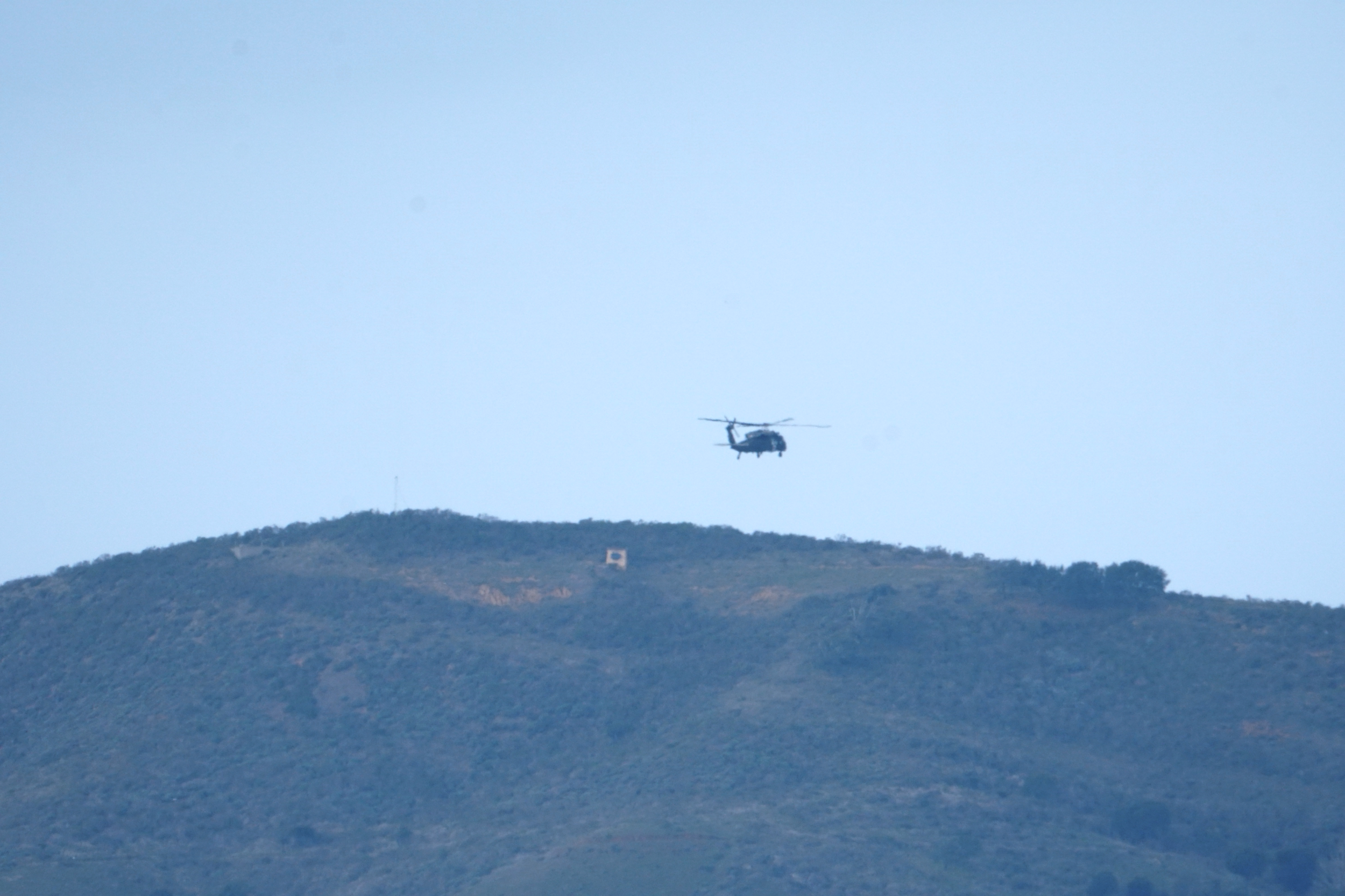
Like this helicopter flying around Angel Island. It didn't show up on any maps, but here it is.
An idea
This whole experience got me thinking about how to automatically capture every military plane that crosses my field of view. Right now, I'm doing it manually when I can. I notice the plane on my adsb raspberry pi map, get the camera, track and focus, snap some shots. Update the photo metadata to match the ads-b info.
I could mount the raspberry pi high resolution lens on a servo and mapped the geolocation of the bay to the ads-b signal. This would track the incoming planes and get decent pictures. After doing some research, it could be done.
Another option is to get a high resolution security PTZ camera and setup a "breach zone" to be the air space above the bay. Any plane that flies into the zone would get tracked and followed. Then I have to grab the video and overlay the ads-b info on the video and you get a sort of heads up display of the plane, the info, and the flight path. The baseline for a high resolution security camera enough to get decent zoomed in images is 8 MP. They go for around $1,000. Here's a decent starting point, https://www.aliexpress.com/i/32874644070.html.
Both are nice projects for when I have more time.